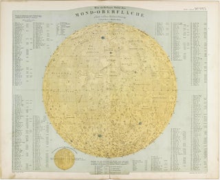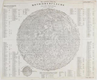
Die sichtbare Seite der Mond-Oberfläche bei voller Beleuchtung nach Beer u. Mädler's Karte.
Gotha: Justus Perthes, 1841. Sheet no. 1 of Stieler's Handatlas. Gotha: Justus Perthes, [1841]. Lithographed lunar map on single sheet, 353 x 422 mm, engraved by Joh. Carl Ausfeld, 1841. Dog-ear at upper left corner not affecting image, vertical crease, little age-toning. A well-preserved copy from the popular geographical atlas..... More