
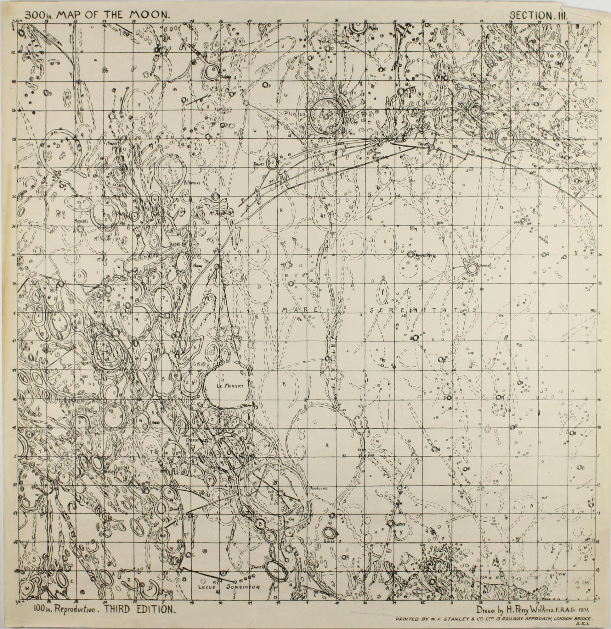
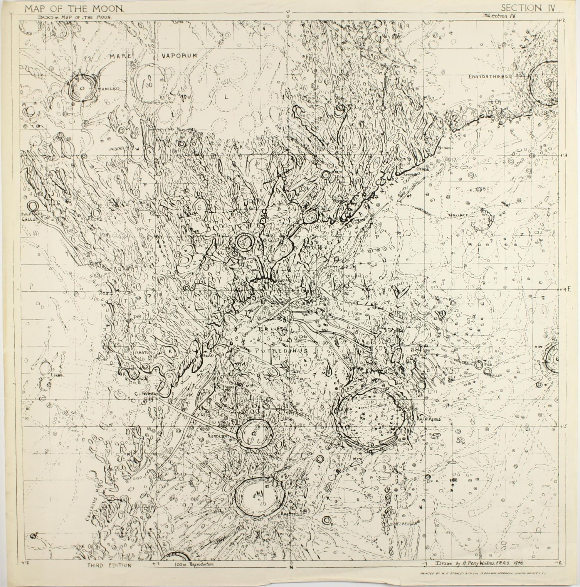
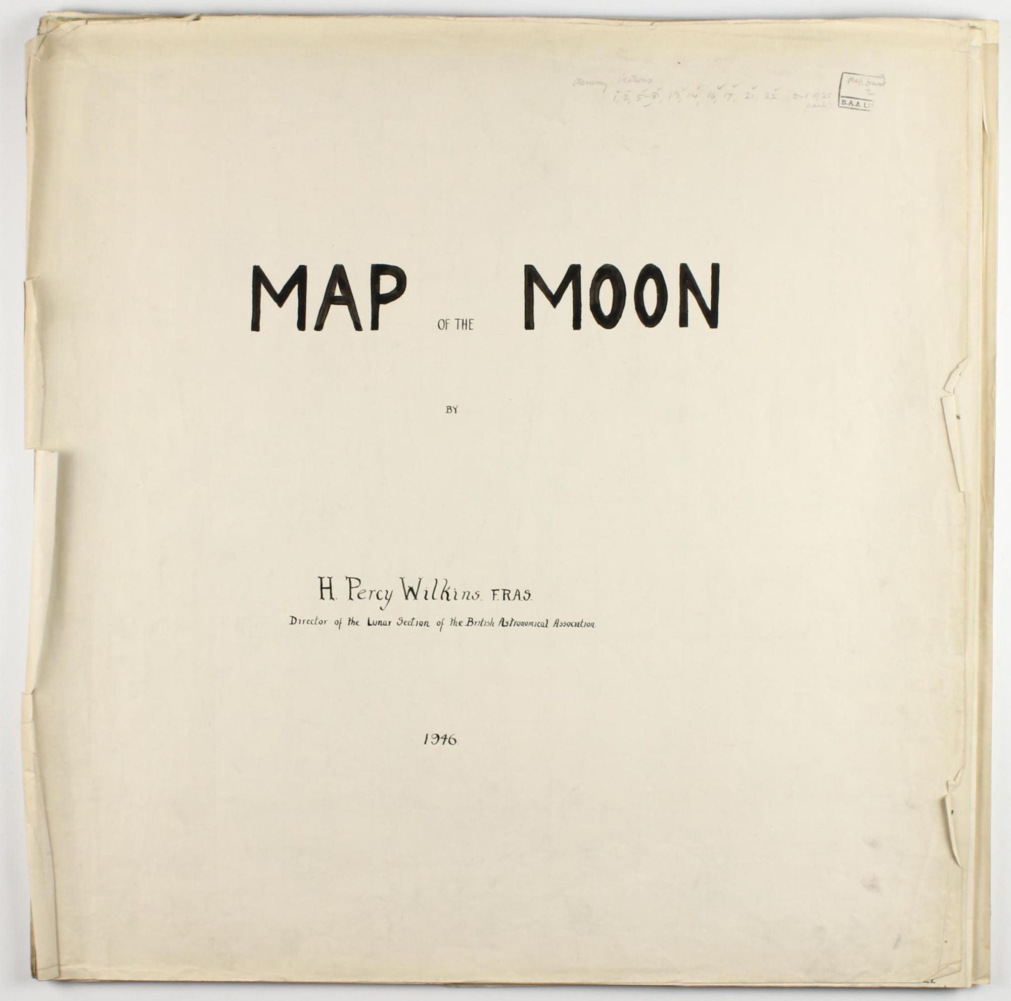
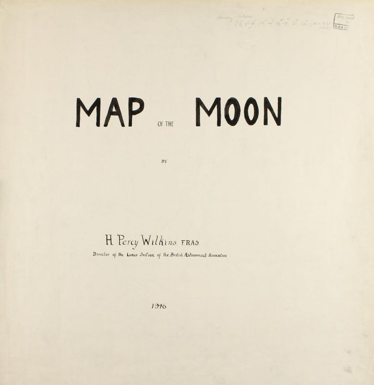
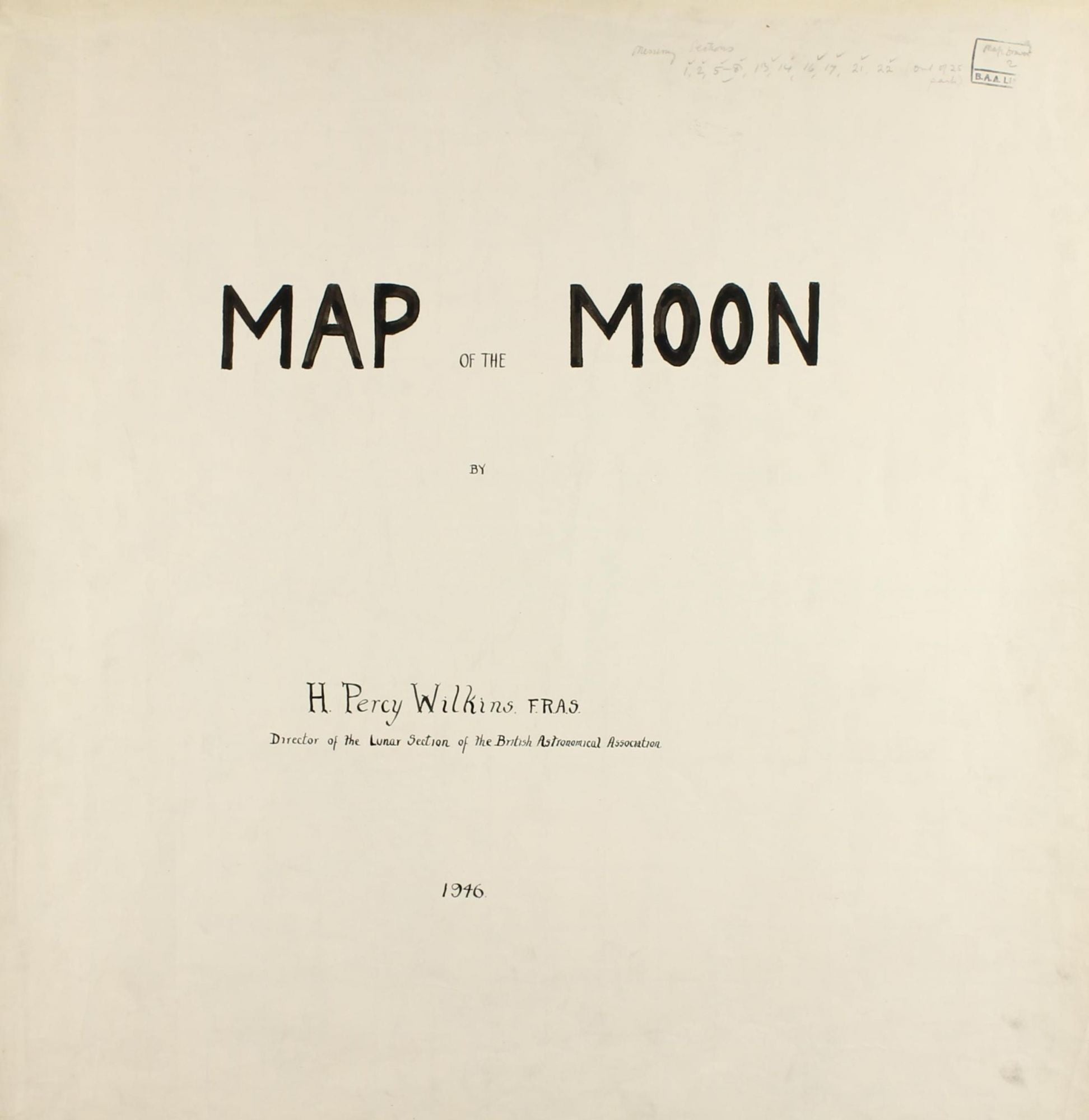
300-inch Map of the Moon.
London: Printed by W. F. Stanley & Co, 1937.
1st Edition. No Binding. Very Good. Item #002216
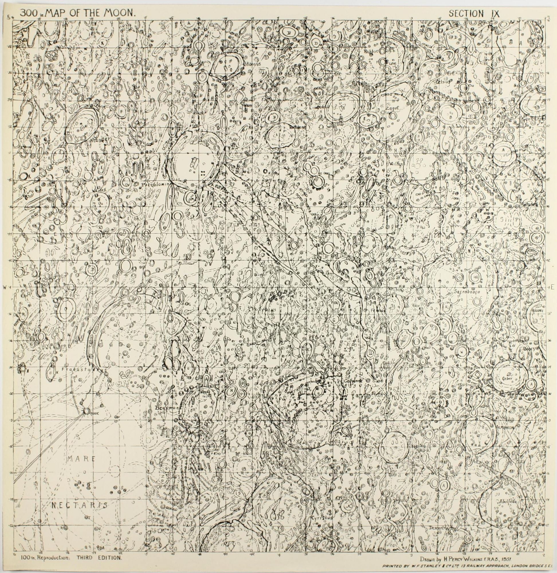
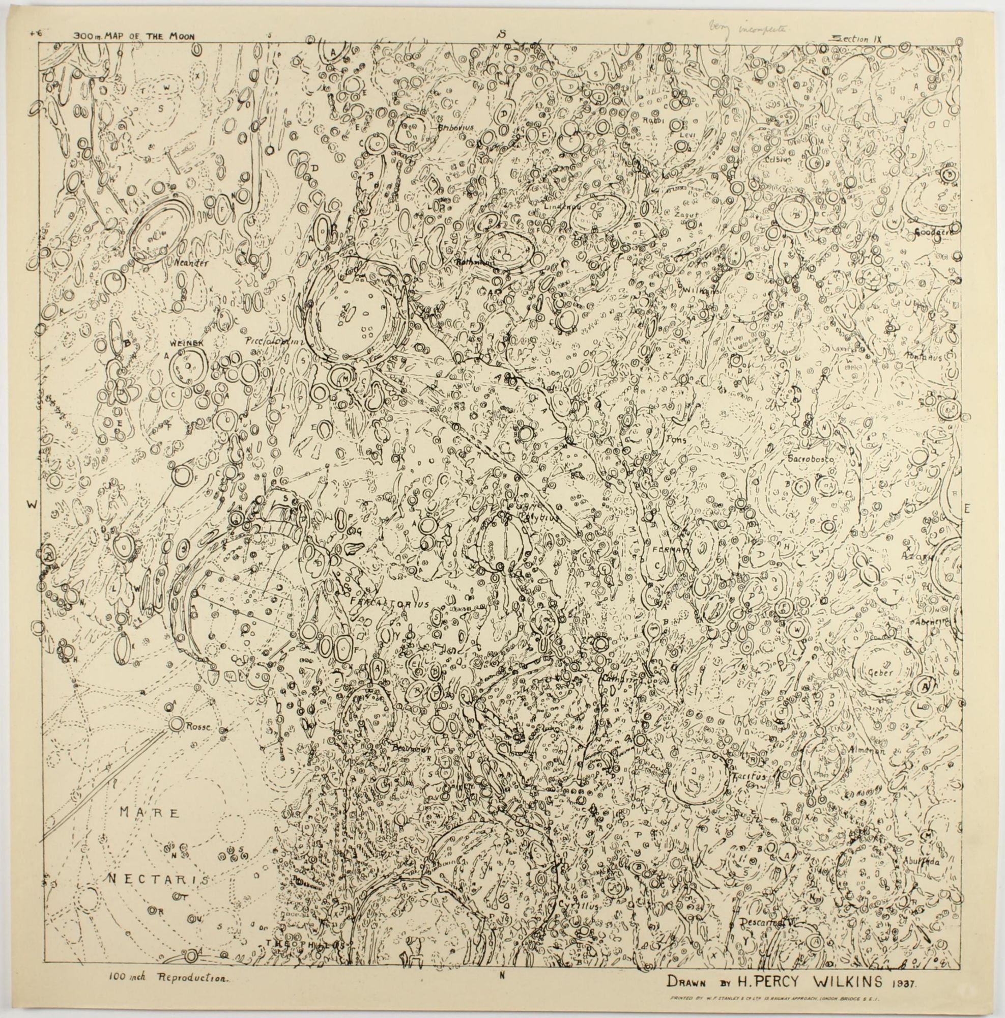
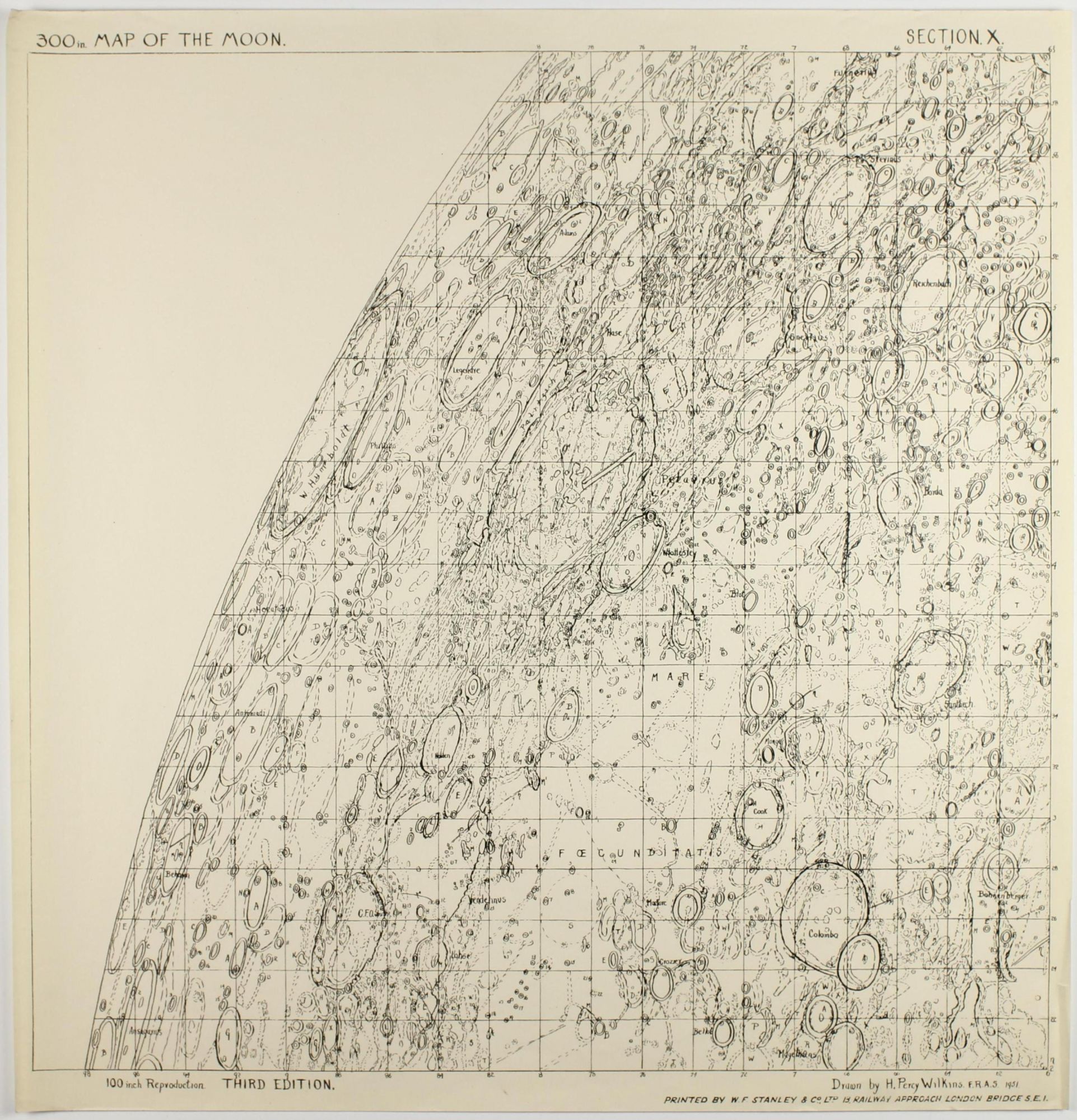
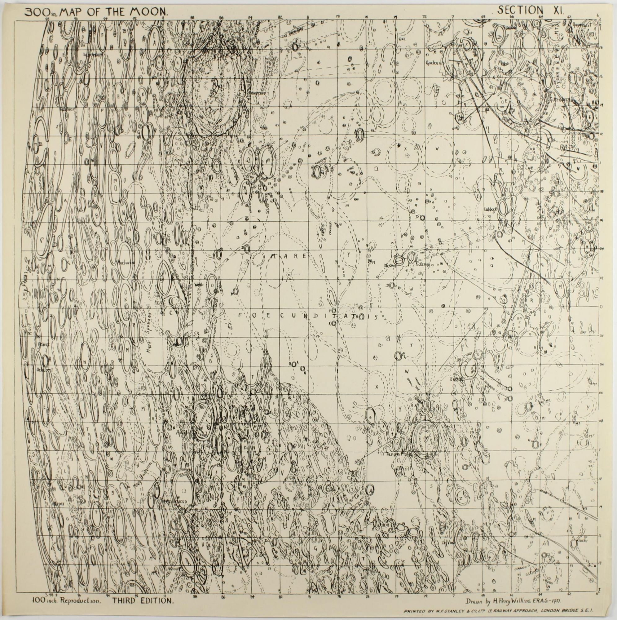
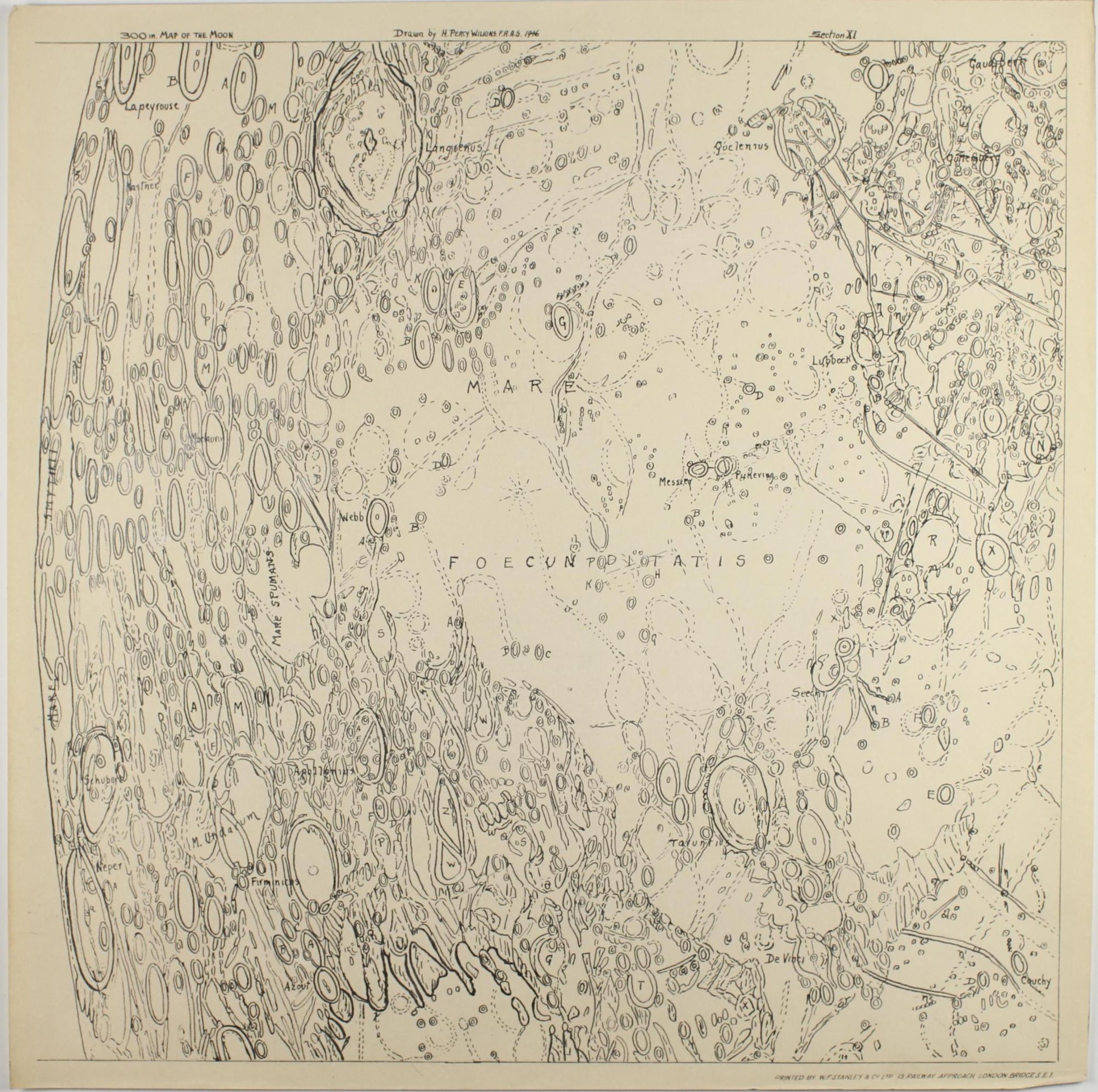
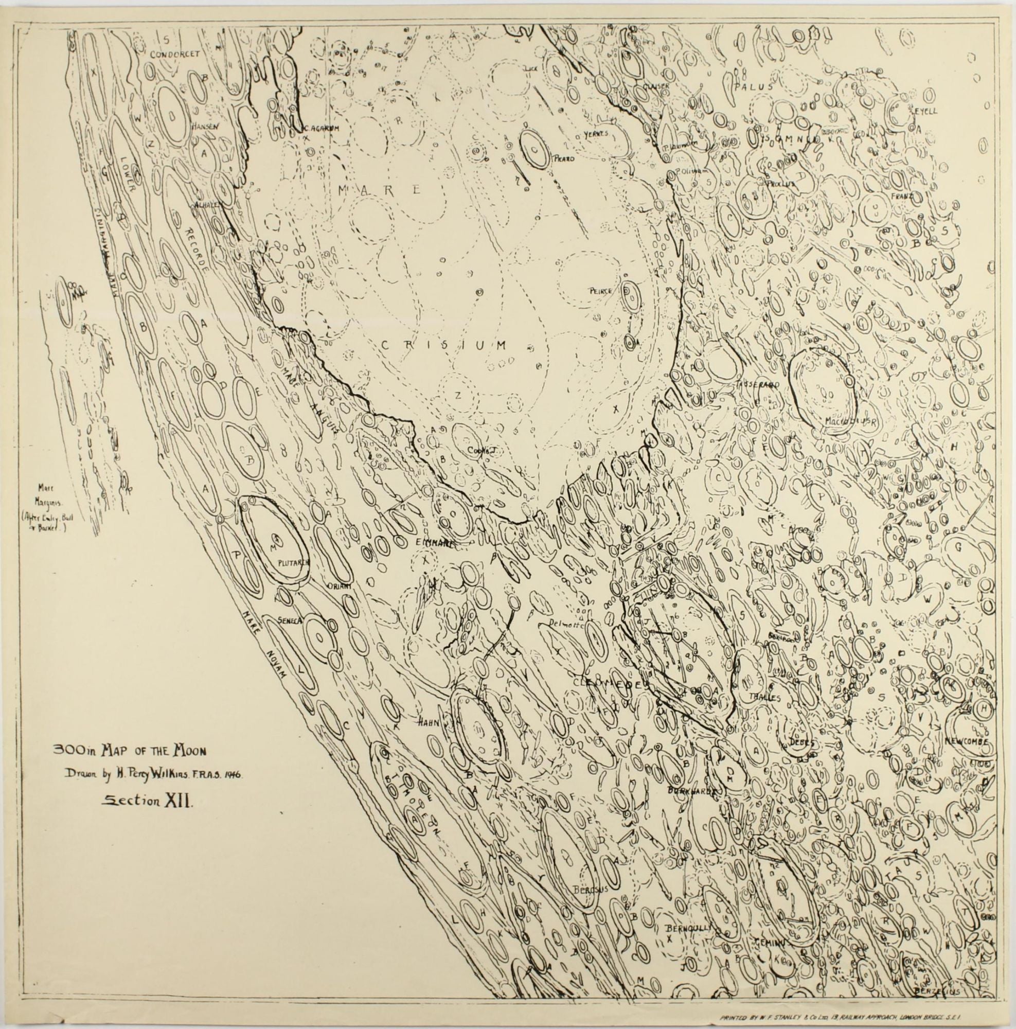
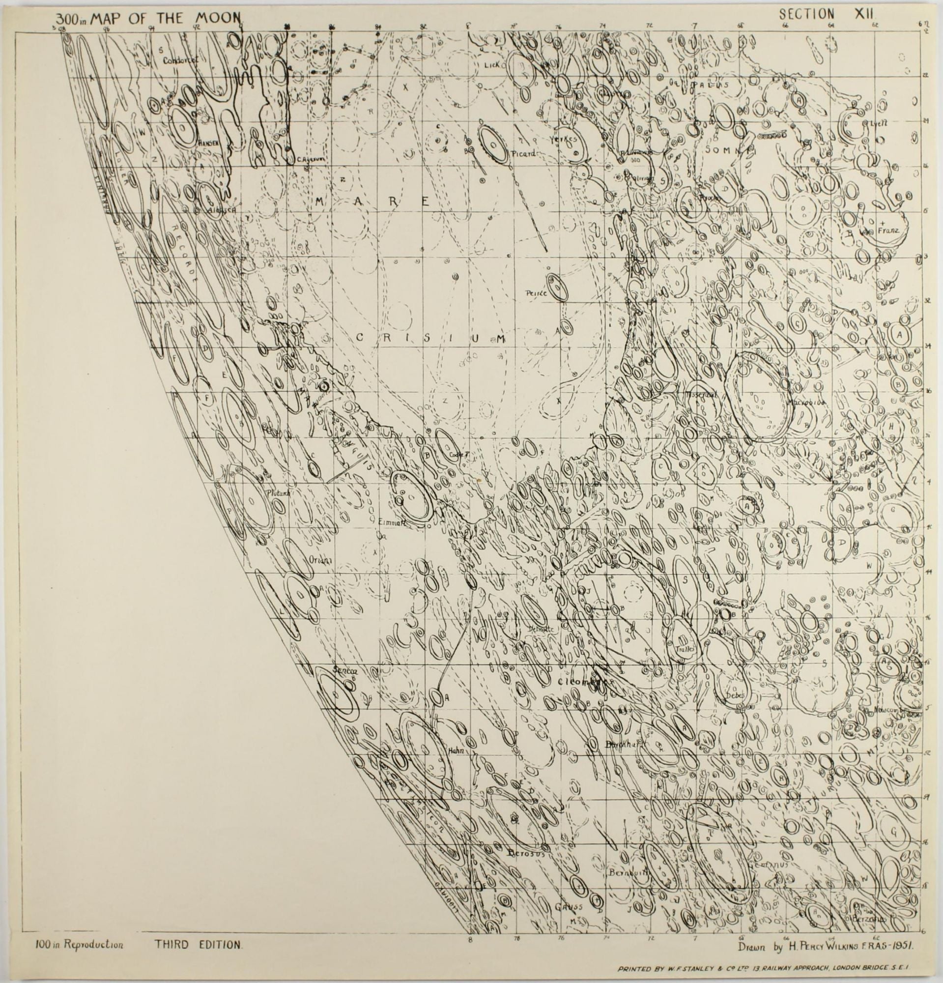
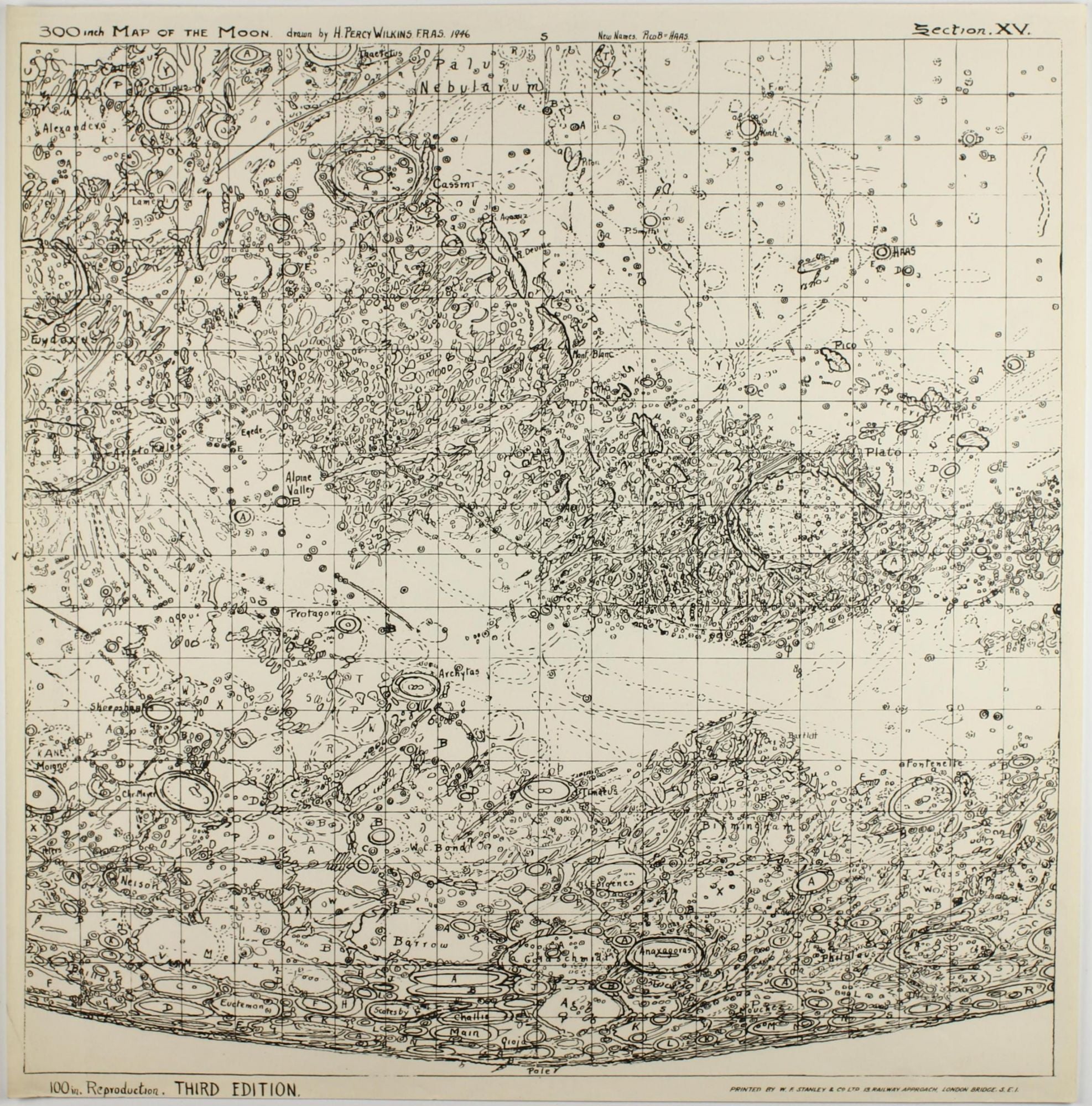
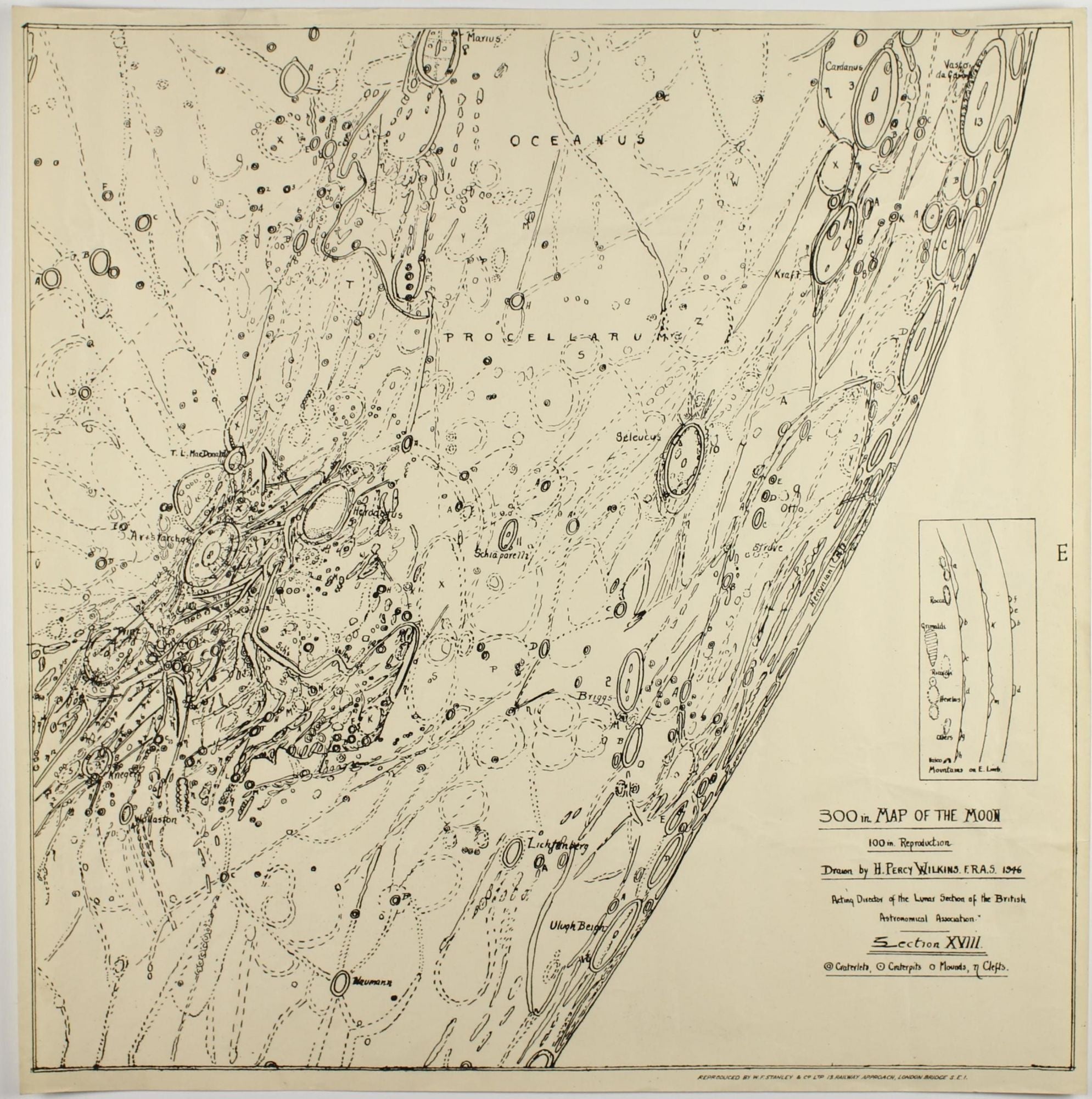
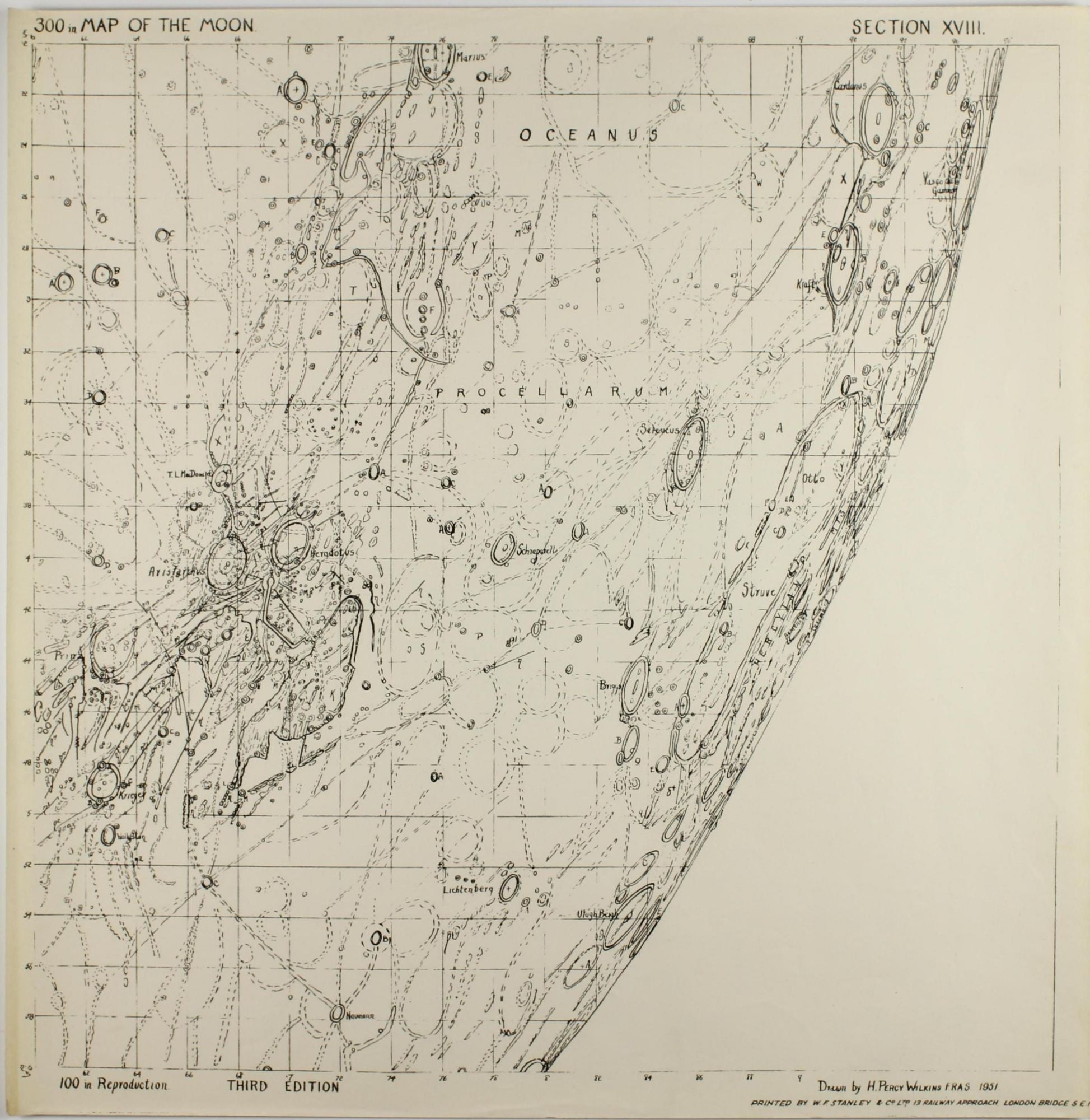
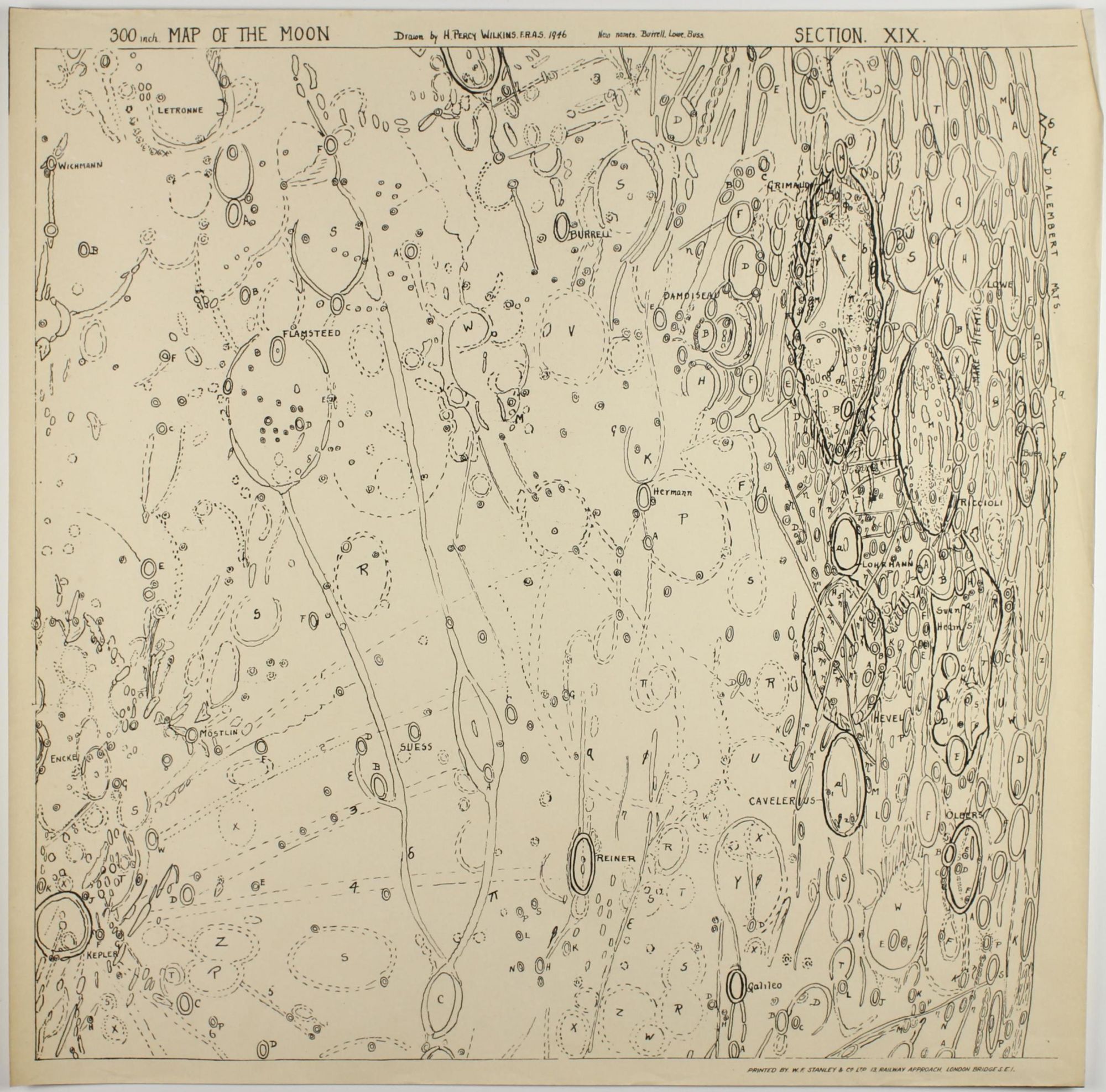
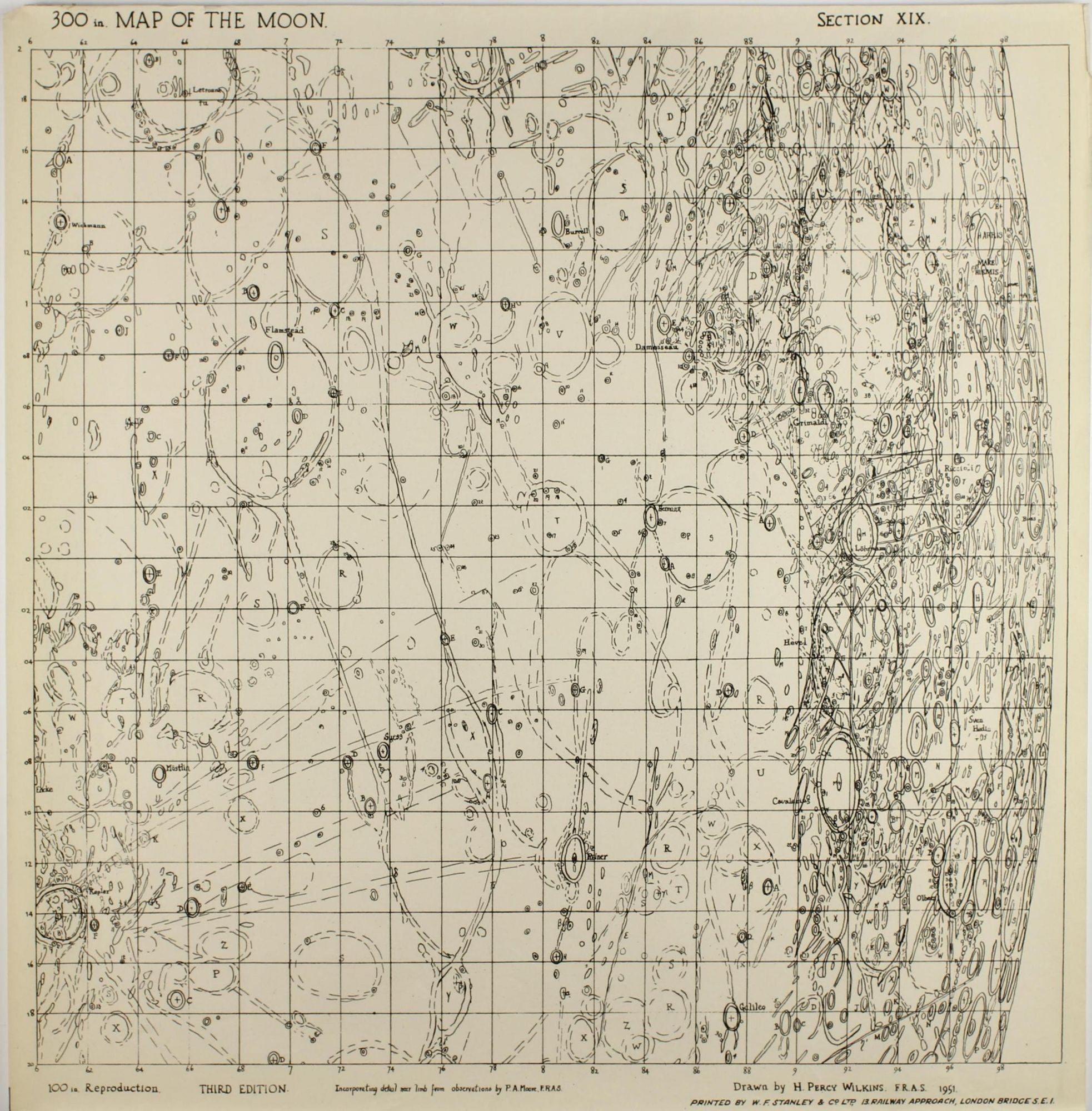
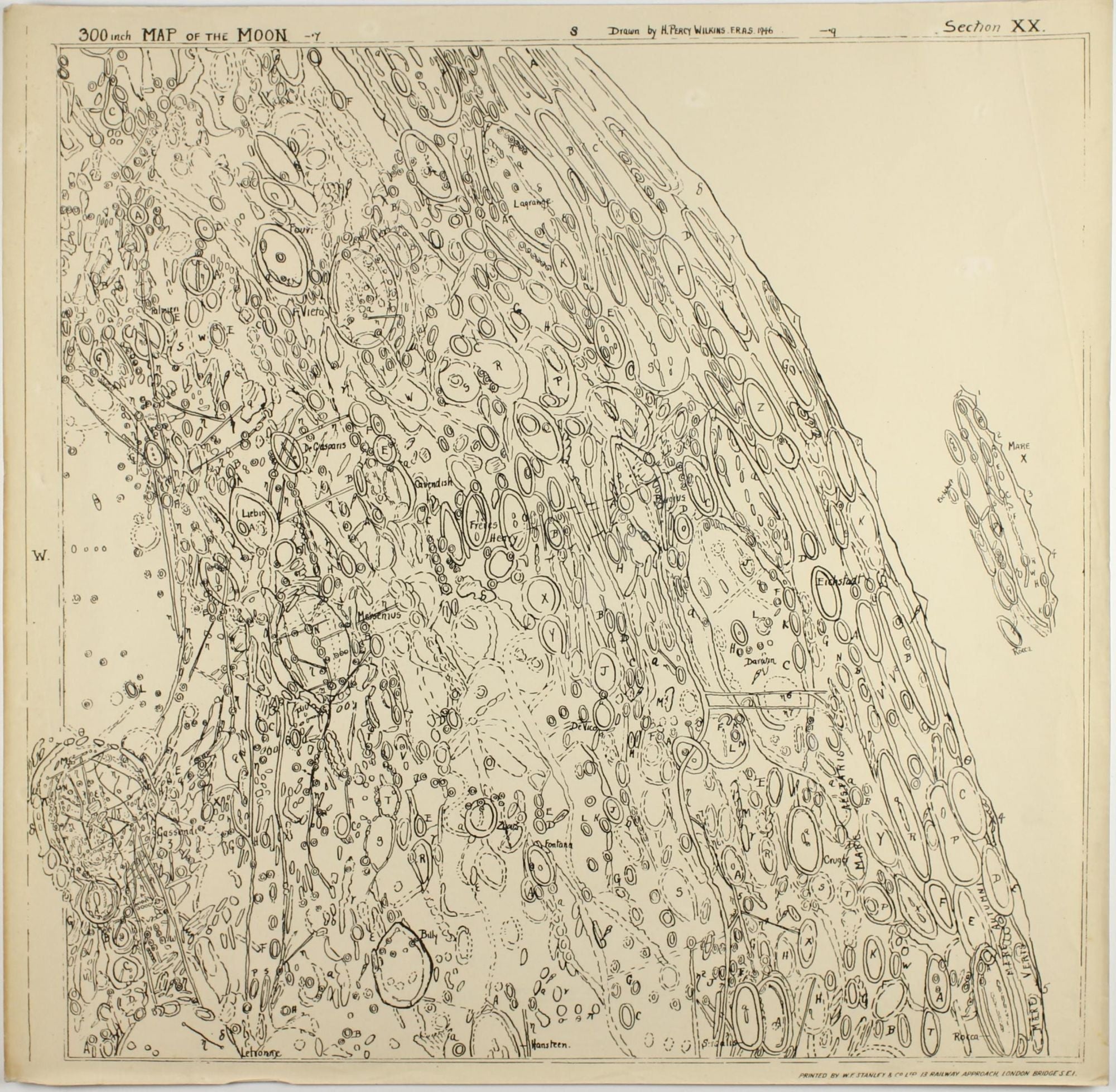
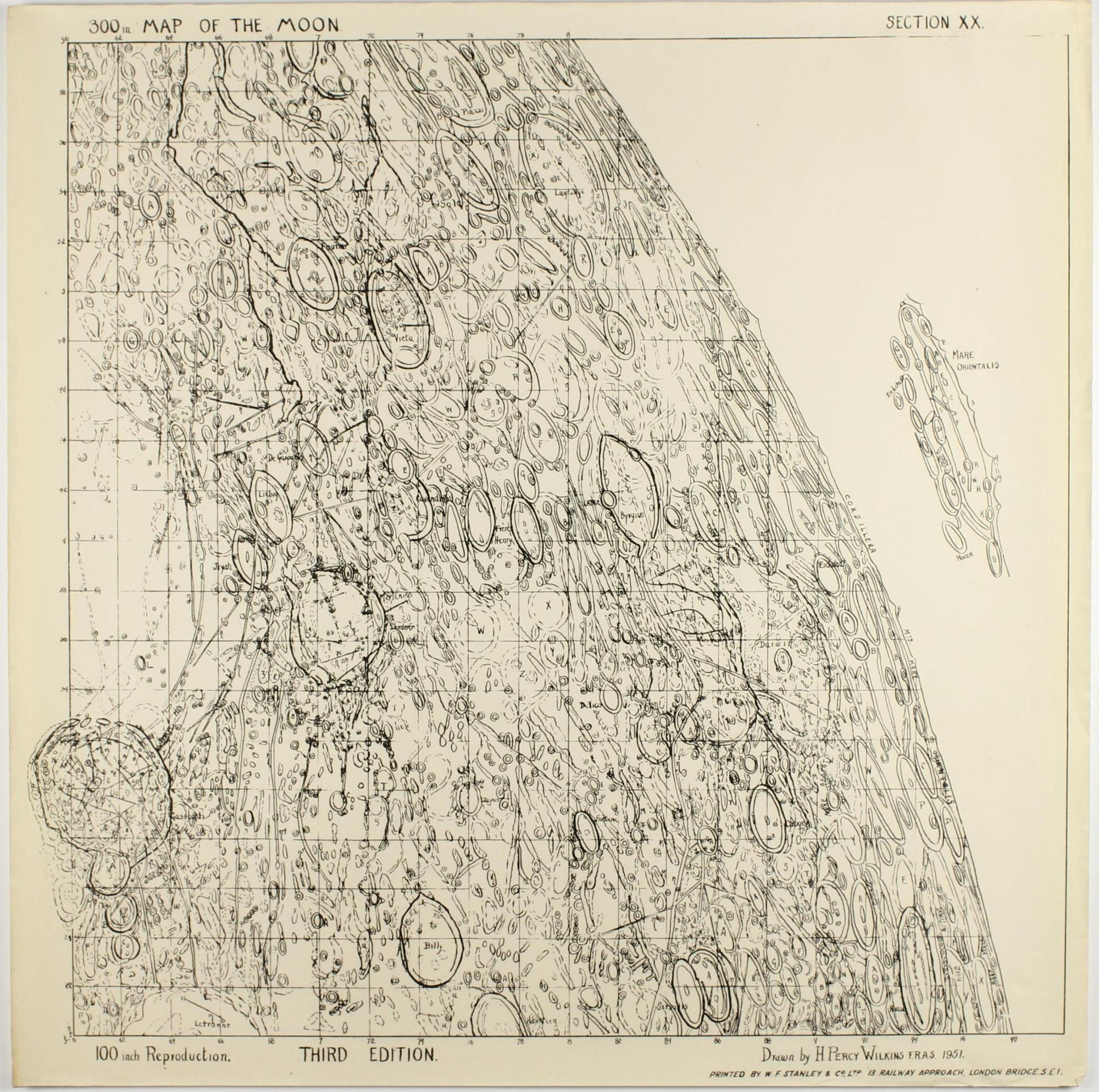
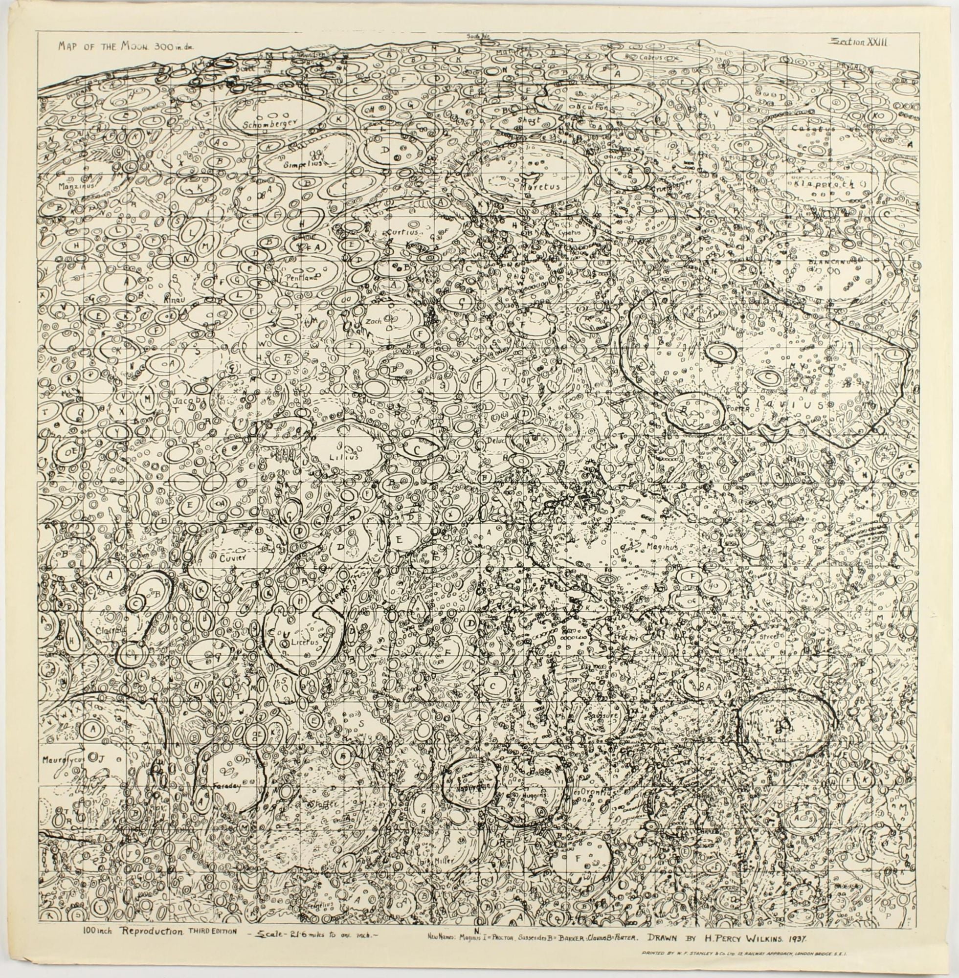
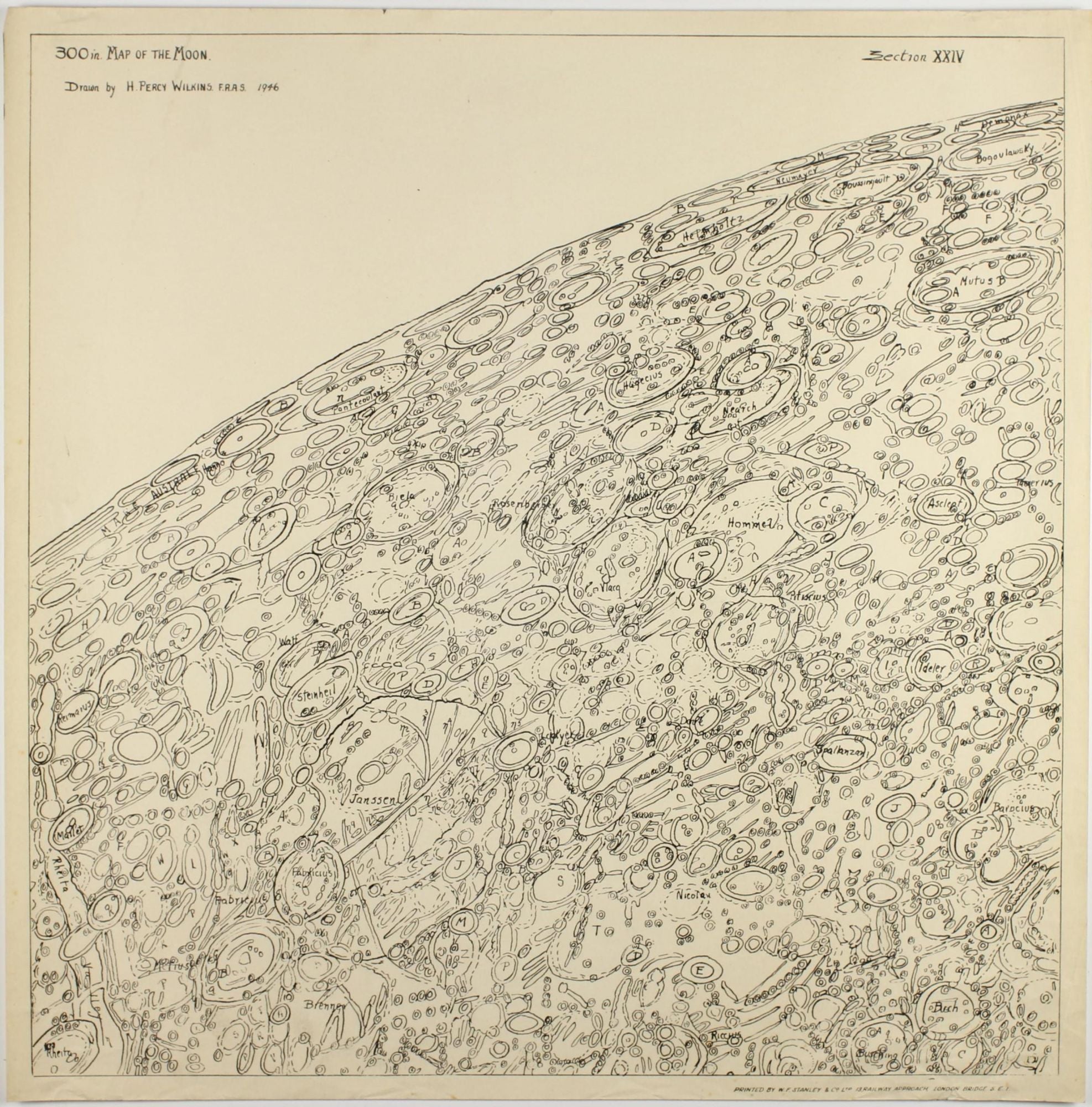
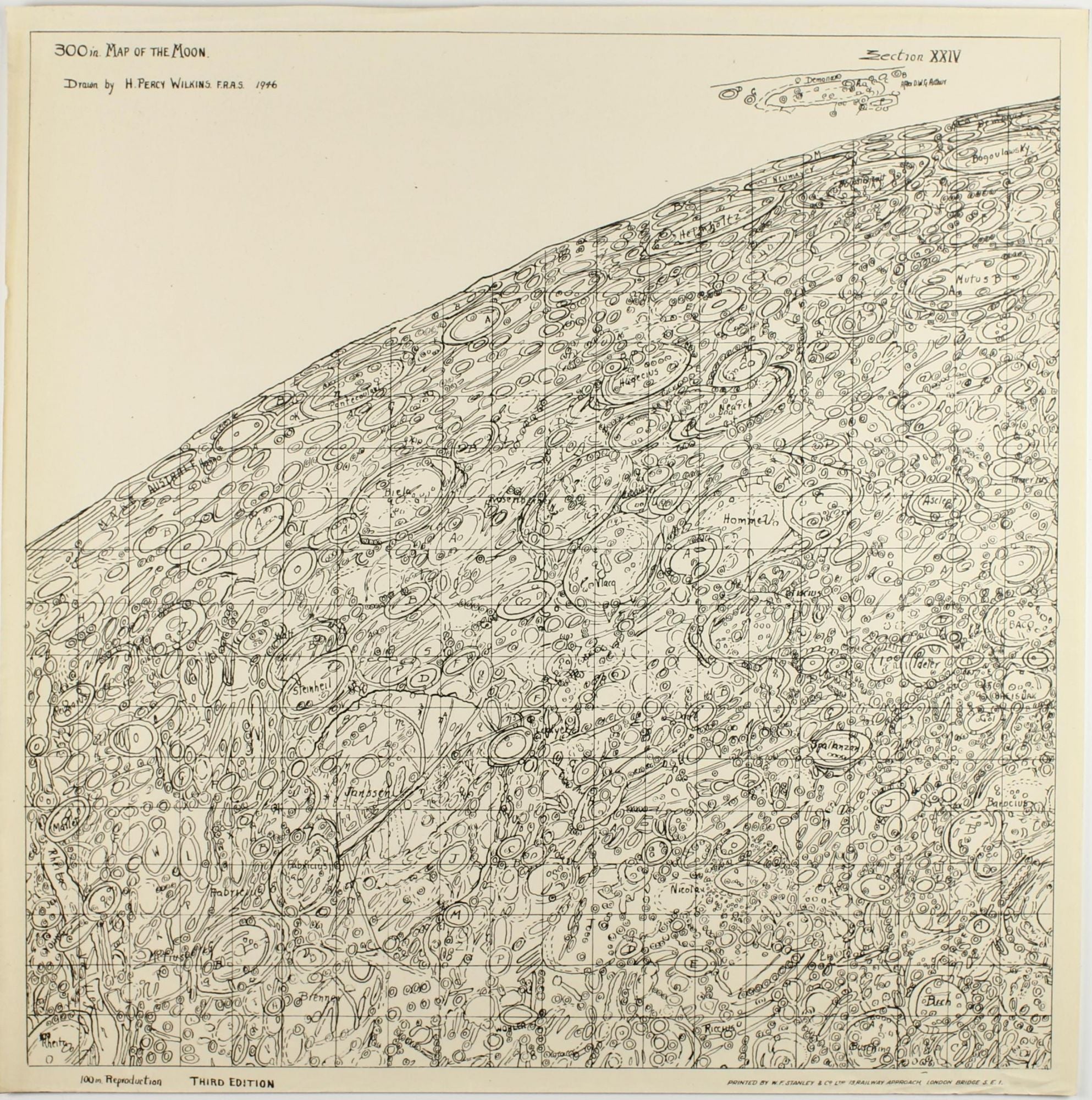
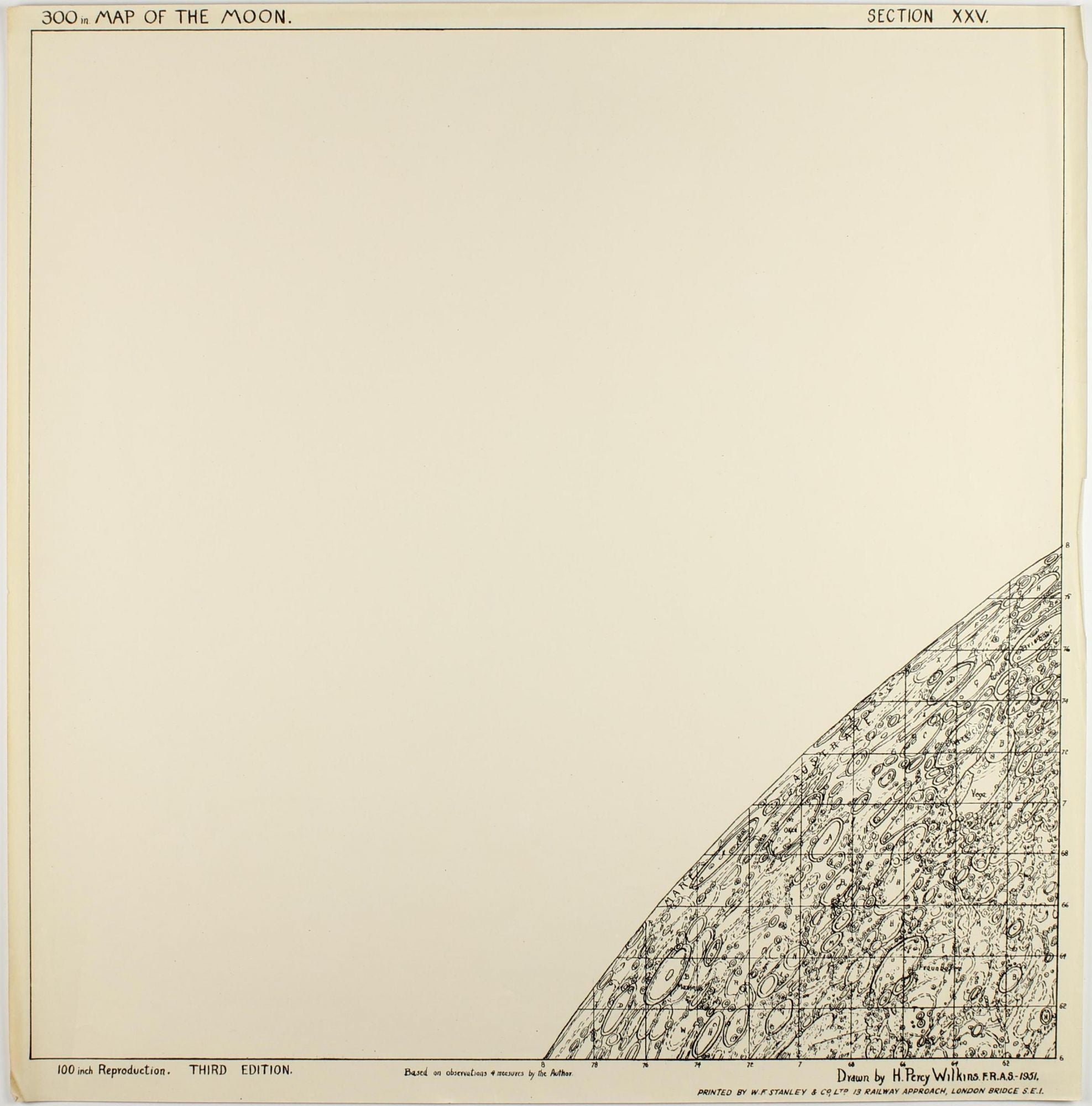
Oblong folio (535 x 550 mm). 23 leaves of square lunar section maps, mixed editions (1937, 1946, 1951). London: Printed by W. F. Stanley & Co. Hand-lettered title-leaf, dated 1946. Sections present, for 1st edition 1937: 9, 23; for 2nd edition, 1946: 4, 11, 12, 18, 19, 20, 24 (+duplicate with added hand drawing); for 3rd edition, 1951: 3, 9, 10, 11, 12, 15, 18, 19, 20, 25. The maps little age-toned, occasional dog-earing. Provenance: Ink stamp of the British Astronomical Association. ----
All editions are very rare. Hugh Percy Wilkins is most noted for his efforts as an amateur astronomer, particularly as a selenographer. He was elected to the British Astronomical Association in 1918 and served as Director of the Lunar Section from 1946-1956. He is probably best known for the classic observing guide he wrote with Patrick Moore. Wilkins produced a number of lunar maps, beginning with a 60-inch map published in 1924. This was followed in 1930 by a 200-inch map, in quadrants, that was also printed in reduced size as a single image 30 inches in diameter. He then commenced work on his 300-inch map, which first appeared in 1946, with revised versions issued in 1951 and 1954. Wilkins and Moore reproduces the 300-inch map in reduced-size sections. This map was considered by some as the culmination of the art of selenography prior to the space age. However Wilkins' maps were dense with detail, some of which was fictitious, making them less useful than most. The Goodacre and Mee crater names from Wilkins' 1924 map he were part of the original IAU nomenclature, as was the name of Wilkins himself (reportedly proposed by Karl Müller). According to Whitaker (p. 230), at the 1948, 1952 and 1955 General Assembly meetings of the IAU, Wilkins proposed 96 new names from his 300-inch map. None of these proposals were accepted, but 16 of the names have subsequently been used, almost always for a feature other than the one proposed by Wilkins. Most of Wilkins' suggested names are printed in an Appendix to Wilkins and Moore (Wikispace). A full-page reproduction of Section XXIII is shown in Whitaker, p.172 with his remark that "the addition of fictious fine detail has so cluttered the map that it is virtually uninterpretable." (Whikaker, Mapping and Naming the Moon, p.171-72). - Visit our website to see more images!
Price: 4,500 € * convert currency
Delivery time up to 10 days. For calculation of the latest delivery date, follow the link: Delivery times
Lieferzeit max. 10 Tage. Zur Berechnung des spätesten Liefertermins siehe hier: Lieferzeiten